 beachrealtors.com
Seabreeze Ridge
Seabreeze Ridge features engineered dunes, rigid historic setbacks, and limited but scenic public overlooks shaping view and buildable land.
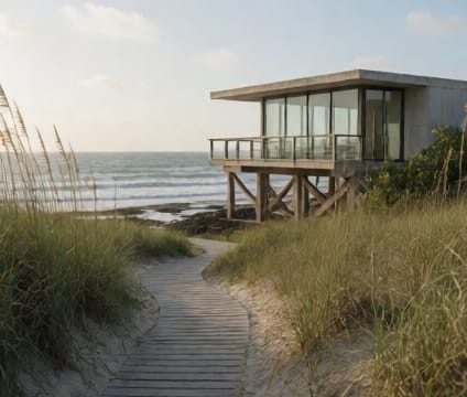
Fixed dune systems in Seabreeze Ridge were constructed over decades to halt erosion and provide passive storm buffers. These dunes are typically crowned with native grasses and low shrubs, with footpaths often restricted to preserve integrity. Understanding their location and elevation is critical, as building near the dune toe can trigger erosion and increase vulnerability during overwash events. Buyers should verify dune line boundaries during due diligence, as some structures were grandfathered in before stricter enforcement.
Setback lines here follow historic survey lines established in the 1970s, often ahead of current best practices. This creates irregular buildable footprints and can prevent expansion even when existing structures are older or smaller than current standards allow. The ridge’s topography compounds this—steeper slopes narrow usable space further, making lot shape and orientation more consequential than in flatter zones. Permits often require surveying against original plats rather than modern records.
Public overlooks sit atop the dune ridge and offer sweeping ocean vistas, but access is typically seasonal or via managed trails. Some overlooks include interpretive signage about dune ecology and storm history, while others are simple benches with directional markers. Though not always adjacent to residential parcels, they influence neighborhood character and can serve as natural reference points during navigation. Their presence also reflects regional conservation priorities that guide future zoning adjustments.