 beachrealtors.com
Seabrook Island, SC
A car-restricted core, century-old live oak corridors, and broad conservation easements define this low-impact barrier island community.
The island’s internal streets—many named for native flora—were designed around foot and golf cart traffic rather than automobiles. The central village center is accessible only via trolley, bike path, or private carriage road, and all residential streets lack curbs or sidewalks suitable for through-vehicle passage. This layout preserves tree canopies, reduces stormwater runoff, and limits light pollution near nesting sea turtle zones. New developments must conform to setback requirements that buffer marsh frontages and preserve interior pinelands.
Conservation easements cover a majority of the island’s land area, held by a regional land trust and enforced through deed restrictions. These protect upland pine forests, maritime oak groves, and marsh corridors from subdivision or commercial conversion. Homeowners in the core neighborhood are bound by architectural review boards that enforce materials and setbacks meant to blend with native dunes and live oak roots. Fire lanes and utility corridors follow existing forest clearings rather than cutting new paths.
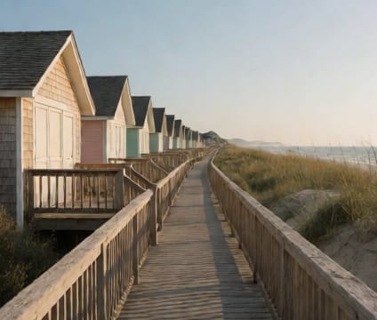
Public access points to ocean beaches are tightly managed via numbered beach access lanes that double as emergency vehicle routes. Trails linking the marsh side to the sound side remain unpaved and often flood during high tides, requiring seasonal rerouting. Schools, the island chapel, and the public library cluster near the island center—no more than a ten-minute golf cart ride apart—while most commercial services sit outside the core, reachable only by trolley or external bridges.